It looks like we are in for some real winter. This morning the thermometer read -3º F (-19ºC) on the sunny side of the house, and the wind in my face just plain hurt. Only my sense of humor calls this weather “a bit brisk”. It is dangerous.
Not that you can’t adapt to it, and take proper precautions, but amazingly few dress correctly. They attempt to dash from heated cars to heated buildings without spoiling their fashionable demeanor with all the woolen stuff that can make a slender woman look like she weighs 200 pounds, and messes up her hair, and makes metrosexual males look like the Pillsbury dough-boy with very skinny ankles. So, instead, they attempt to make it from their parked car to the door dressed like it is April, and practically perish in the wind. Bozos!
Fashionable demeanor? They wind up looking like crippled cats with their tails ablaze, as they painfully limp in super-fast-motion through powder snow above their shoe tops, with wind whistling through skimpy clothing. (It’s called “a lazy wind”, because it can’t be bothered go around you, and short-cuts right through you.) Bad hair day? If the wind and static electricity doesn’t frizzle, the simple fact heating bone dry air seventy degrees creates indoors humidity around 5% can make the the most starched hairdo look like a mad scientist’s. This sort of cold takes dignity and grinds it under a cruel heel.
I suppose this idiotic behavior proves the Global Warming Alarmists were quite correct when they prophesied, “In the future people will not know what winter is like.” They were not false prophets. They just failed to mention they were not talking about the weather, but rather about the dumbing-down of the public to a point they don’t even know how to dress correctly when it is bitterly cold.
Forgive me if my tone is sardonic. You need to understand I have been taking a drubbing for over ten years, for simply stating the obvious, which is that Global Warming is not a crisis, but a weather cycle that lasts around sixty years, superimposed over a solar cycle that seems to last around 200 years. I have been called things that you wouldn’t believe for being a Skeptic, and have even been told I should be locked up. This does tend to make a man bitter. So does a wind chill of -25ºF.
I looked in the mirror when I came indoors this morning, and looked as bitter as the central character in this Boston Globe cartoon dated 1917.

My sister sent me the cartoon, after it was printed in the current Boston Globe. This actually surprised me. The Globe is infamous for printing only the news that supports the concept of CO2-caused Global Warming, and for utterly ignoring the evidence of the past, which tends to suggest “the only new thing in the world is the history you haven’t studied.” For them to allow even a suggestion we have seen the current weather in the past is highly unusual. They actually have deleted such suggestions from their various websites, in the past.
I wonder. Can the times, they be a-changing?
I wonder. Under a former president, (who I will not honor by naming), vast amounts of money our government does not have was printed, and handed out to any who would further the idea Global Warming was real. Science was degraded, reduced to absurdity. But now President Trump is horrifying people by turning off that faucet of funding. The Globe has written with great zeal how propaganda science cannot survive without billions of dollars being spent. Yet even the Globe must understand that, without funding, certain news is less profitable to be associated with. Not that they will ever admit such news was “very fake news”. But perhaps, slowly but surely, and by small increments, they are changing their “slant” and “spin” to a degree where they can allow evidence from the past to ink their pages.
I wonder. Is it too late? The dumbing-down of the public has been going on at least since Hansen testified before congress in 1986, if not longer. An entire generation of school-children has been brought up to blithely believe Global Warming is a fact. But the current blast of cold isn’t ancient history. It isn’t happening in 1917. It does no good for me to point out the real facts, the real history, the real temperature records from before Hansen wasted such unbelievable amounts of tax-payer money “adjusting” the actual temperatures recorded by actual people. The past doesn’t matter. What matters is the killing blasts coming south. Are we prepared to handle them?
One funny thing is that the only happy people in the above cartoon from 1917 are the plumbers. I met such a plumber yesterday, just inside the front door of my church, down on his knees. He wasn’t praying. He was attempting to thaw the pipes of a radiator. I asked him if he was busy, and he replied “Not yet.” He went on to say our heat was set too low, as are other households, and he expected that, as the arctic outbreak grew worse, he’d be working non-stop.
Sad. People turn down the heat to save money. But plumbers are not cheap.
My main hope is a “pattern flip”. Old-timers call this a “January Thaw.” Our winter temperatures tend to bottom-out around January 19, but if you scrutinize the local temperature-graph one sees the bottoming-out isn’t a smooth curve. It is a bit like a roller coaster at the bottom of the yearly curve. Despite the fact 125-years of records tends to average-out yearly spikes, there is slight evidence (more obvious at some sites than others) of a slight January Thaw around January 11 and a greater one around January 22. However there is a lot of variability. Some years the thaws are brief and slight. A true “pattern flip” sees a cruel winter give way to a delightfully prolonged thaw. But…there is the worst case scenario to remember, when the thaw is skipped, and the winter just goes on and on and on until you are ready to scream.
I am old enough to remember the winters of the late 1970’s. (1976-1977 started earlier than this one, and went without a lasting thaw until late February). (1978-1979 started late, but amazed even the lobster-men of Maine by breaking some of their weather-rules, and freezing up harbors later than they had ever seen.) At that time the media exclaimed about Global Cooling and A New Ice Age.
I hope we don’t see that. I’m hoping for a “pattern flip”. That will give us enough cold to wake metrosexuals up, like a shot-across-the-bow, without really hurting them.
As it is, it looks bad for two to three weeks. An amazing reservoir of cold air was nudged south from the Arctic Sea and is now heading our way. A second reservoir of very cold air was bumped from Eastern Siberia up over the Pole, and via “cross-polar-flow” will likely follow the first arctic outbreak. After that? Hopefully the pattern will flip, and winds will stream up from the southwest.
For those of you who like maps, here is our current map:

The front down in the Gulf of Mexico and crossing Florida was the first arctic blast, which I suppose some will now call a “polar” front. The “arctic” front, holding a reinforcing shot of colder air, extends from south of us to a low over the Great Lakes called an “Alberta Clipper.” Waxing poetic, (all meteorologists are secretly poets), Joe Bastardi explained, “The emperor of the north likes to lay down a white carpet to announce his arrival, and that is what the clipper shall do.”
I won’t mind a clipper, for that tends to be the sort of snow you can broom away.
What I am more nervous about is the gap between the coming arctic out break and the following one. East coast blizzards can occur in such gaps. (Next Thursday).
We are actually fortunate because the worst cold is coming south to the west of the Great Lakes, and then turning east. It must cross the Great Lakes before getting to us, and those waters are still in the process of freezing. Until they freeze, they warm all air passing over, (and this causes enormous “lake-effect” snows to our west). By the time the cold gets to us it is only -6ºF rather than -30ºF.
If you are interested, here is our local forecast: (Temperatures in Fahrenheit). (Notice warming and snow next Thursday, followed by arctic blast. Storm?)

This will be rough, in terms of heating bills. The poor will get poorer. Some elderly will die in cold houses, and some homeless will freeze on the streets. Those who got rich promoting solar power will not care, although those who thought they could retire to Florida may face face frost and snow, even there.
In terms of running my Childcare, we will venture out on hikes, but they will be short ones. If it is windless we will build a bright fire and let children play on the farm-pond’s thick ice. But even a slight wind can be very cruel, and I am not such a zealot about the outdoors that I risk frostbite. Legos are an acceptable alternative. Here is the work done by a boy aged four, today:
 It just goes to show you cold can’t stop the children.
(I’ll update this post with end-of-month statistics of what our temperatures actually were. They tend to be lower than forecast.)
Friday Update

Clouded up before dawn and the temperature rose to -3° F, from a local low of -9°F (-23°C) around three AM. The sun was a brief glow to the east before settling to a light gray smear in the southern sky during the short, gray day. The temperature peaked at around 6°F, (-14°C) with the lightest dust of snow sifting in a light wind. I took a couple of boys out to whack a puck around the pond in the afternoon, not bothering with skates, for by the time they had them on my hands would have been frozen, and they’d want them off. We lasted 20 minutes.
It is interesting how much the forecast for next Thursday has changed.

That is a shift twelve degrees downwards in 14 hours, and demonstrates the long-term reliability of models.
Here is the evening map. They did not bother draw in any fronts for the weak impulse that passed over and now is south of Nova Scotia. I call such subtle features “ghost fronts” because they persist although invisible. Don’t be surprised to see it reappear north of Nova Scotia tomorrow. It is a piece of energy tippling along what theoretically is the warm front of the Alberta Clipper bogged down and occluded over the Great Lakes. (The “warm” water of the lakes is creating rising air, causing that stalled feature to persist, rather than fade away.)

SATURDAY MORNING UPDATE
5:30 AM: Down to -7°F last night, but now up to -4°F as high clouds stream in from the west. Check morning map:

Sure enough, the “ghost front” feature has reappeared north of Nova Scotia. I call these lows “zippers”. They ripple along a warm front when the main low has occluded, and are more obvious in Europe, when a big Atlantic gale stalls and occludes. Our occluded low is a weakling Alberta Clipper malingering over the Great Lake’s updrafts. A new Alberta Clipper is sliding east to its southwest, bringing us high clouds. The snow will likely stay south of us. Behind it is nasty cold. I wouldn’t like to be at the Patriot’s game this Sunday.
Sometimes these surges of cold from the north bring about an equal-but-opposite surge from the south, but the warmth is still milling about in the Gulf of Mexico, and as of now shows no sign of charging north as a storm.
The equal-and-opposite reaction that you can safely predict with a high degree of certainty is the reaction of Alarmists to the bitter cold:
Record Breaking Winter Cold? Don’t Worry, the Climate Explainers Have it Covered
Hansen, who formerly predicted that Manhattan would be awash under rising seas by now, is now predicting the warming he predicted will be hidden by brief mini-ice ages.

These fellows seem to just make things up as they go. However, judging from the over-500 largely-sarcastic comments to the WUWT post, people are not buying it any more.
 9:00 AM — Up to 3°F (-16°C) under gray skies. Heat Wave!
The forecast for next Thursday has switched back to snow, with a high of 21°F and low of -6°F. The model my phone is hooked up with (GFS?) must be struggling with a storm it sees going out to sea one run, and coming up the coast the next.
Why Worry? That’s not happening until sometime next year. Today I just need to deal with the gray.


SUNDAY UPDATE
I thought we might get through a night with temperatures above zero when I awoke at three last night and temperatures were holding at 1°F, but by dawn we had dipped to -3°F, and we have now been below zero five straight nights. Last winter I think we only managed three nights the entire (kind) winter.
Yesterday (Friday) we managed to inch up into double digits, 11°F, but today we only managed 8°F. The occlusion that lay back over the great lakes was swung south by the flow from the north, becoming a ghost cold-front with a ghost-low and even a ghost warm-sector on it. (Not much of a warm-sector, but we’ll take any slight warming we can get, at this point.) One interesting thing about the ghost low is that it in part seems to be a Pacific impulse. If you look back to the start of the post you’ll notice a low crashing into the Pacific northwest. It then undergoes what I call “morphistication” as it transits the heights of the Rocky Mountains. One part of it attempts to reorganize east of the mountains, but higher up in the atmosphere some sort of reflection proceeds merrily across the continent as if the Rocky Mountains didn’t exist. As the Alberta Clipper moves off the coast (after giving us a quarter inch of dusty snow) the ghost low approaches Lake Superior last night:

By this morning the ghost-cold-front (dashed orange line) is settling south to the east, but lifted slightly to the west as the ghost-low moves south of the Great Lakes. (The arctic front is way down to the Gulf of Mexico, and the lower part of the Pacific storm is still entangled in the western mountains.)

By mid morning someone bothered put a small “L” on the map for the ghost-low.

This evening the ghost is passing south of us, with little more than high clouds effecting us (this time; another time it might lead to surprises.) The old Alberta Clippers are brewing up towards Labrador, and a sneaky front is wheeling around over its top. Sometimes blobs of Atlantic air get injected into the arctic flow and we get odd, un-forecast flurries coming down from the north. However I think nervous eyes are more likely looking down at the lows rippling along the arctic front in the Gulf of Mexico, or at the lows malingering out in the Rocky Mountains. Me? I’n just hunkering down to endure the next arctic blast, which was held up slightly by the ghost impulse, but now has a free pass to come south.

A quick glance at my cell phone sees the snow is back for next Thursday, for the moment. I suppose the low out by the Rocky Mountains will combine with some Gulf moisture and try to come north, but be shunted out to sea, but not far enough to allow us to escape the northern, snowy edge. And as it bombs-out in the Atlantic the winds behind it will make us even colder than we already are. Two days with zero (-17°C) for a high temperature! (Let’s hope the models are wrong.)
 This current blast of cold has our local rivers, which are rushing streams people like to kayak on to test themselves, more frozen than we usually see in the very depth of a cold winter, and we’ve barely begun.

Happy New Year!
MONDAY CONCLUSION
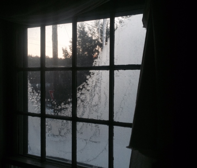
Down to -10°F last night (-23°C), which is the coldest we’ve seen so far. I celebrated a Greenland New Year’s last night (IE I went to bed at nine.) Therefore I could arise early and see the late dawn’s light the frosty windows.
I promised I’d include some statistics, so here is the Concord, NH weather data. Concord is north of us, up the Merrimac River, and because its is down in a valley it can be warmer than us on bright sunny days, and colder than us on still, cold nights, but usually it’s temperatures are close to what ours are.

It’s interesting to look back to December 6, when temperatures touched 53°F (12°C) and December was averaging +4.3 of normal, and the ponds were barely skimmed with ice. Now the month concludes -4.6 of normal, and the ice on ponds is a foot thick. What the heck happened?
One thing that happened is that the winds turned north and stubbornly stayed from the north. Our “warm-ups” involve moderated Chinook air that had crossed an entire continent, and winds just north of west. We haven’t had all that much snow, but it sits and refuses to melt. The last five days of the month have averaged over 20 degrees below normal. That will dent your wallet, when you pay for heat.
Snow is still in the cards for next Thursday, (bitter cold powder, not the sticky stuff children like), followed by another arctic blast, and the long range is now hinting at another storm at the start of next week, followed by another arctic blast.

The map shows the remarkable magnitude of this arctic blast, with the cold front nearly across the Gulf of Mexico to the Yucatan. (Also rising air over the “warm” Great Lakes continuing to fuel a weak low all their own.)

It looks to me like the cold will not hurry to relent. Up at the Pole the flow continues from Siberia to Canada, refueling the source of cold air. However over at the Weatherbell site Thomas E Downs, V posted a very cool analysis of the bitter winter of 1917-1918, (week free trial available). The cold may have caused people back then to stay indoors in close contact, and contributed to the spread and mutation of the so-called “Spanish ‘Flu”, as troops were mobilized and sent overseas. The pandemic reduced the world population by roughly 5%. Not the nicest winter, or spring. (My Grandfather nearly died of the ‘flu in France.) But one thing Thomas Downs points out is though the cold remained brutal right through January, the pattern-flip in February must have felt like heaven to people in the northeast USA. (Last 10 days of January to right; Mid-February to left.)
It also is likely that those who do best in harsh winters are those who avoid skulking indoors, and instead embrace the discomfort, and go out to take pictures, to show to their grandchildren. I’m glad people took pictures in 1918.

I’m going to post some pictures of our frozen streams and rivers. Stay tuned.


