When troubles come in clusters I try to take an upbeat attitude, and say something along the lines of, “It’s better to get them all done with at once,” and, “Once I get through this, there will be a long spell with no trouble at all.”
However this time it wasn’t working. Some things, such as a mother-in-law struggling with dementia, are not a thing you can fix. Other things, which you should be able to fix, (such as the well at the Childcare), defy diagnosis and remain troubles even when you attempt to deal with them head on.
Then, just when I needed to be especially strong, I wound up in a hospital with pneumonia, and my upbeat attitude got a bit frayed. (Usually I find hospitals fascinating places, but there are troubles they face these days I couldn’t fail to notice and be nosy about, and my frayed attitude soured further.) Then, when I got home, I faced a very sick dog that likely would have to be put down.
The vet agreed, and my friend of fifteen years went to the Big Sleep with me petting her.
Then the vet asked me a question he likely asks by rote, somewhat hardened by having to experience the death of pets so often. “Would you like us to dispose of the dog for you?”
“Dispose”. What a word. I shook my head.
“If you wish we can cremate, and give you a box of ashes.”
I shook my head again. Then I found the words. “I think I’ll have a quiet funeral in the back yard, and bury her next to others.” The vet’s staff placed Elsie’s body in the back of my Jeep, and I headed home.
In actual fact I wasn’t at all sure I was being wise. Five years ago I could still dig a hole four feet deep, four feet long, and two feet wide in twenty minutes, in stone-free soil. But pneumonia had made a weakling out of me. Even walking seemed to require a caution I never took before, (unless I was very drunk.) I told someone that rather than spring in my step I had fall in my step. And I expected myself to go out in the back yard and dig a decent grave?
But all I had to do was think of that word, “dispose.” A dog deserved more dignity than that. Elsie wasn’t some tissue you use and then throw away. She held life, and life deserves respect.
I wasn’t being sentimental. To be honest, I surprised myself by noticing a flint-like hardness in my attitude. I reckon it has a lot to do with the political climate we are enduring, where it seems Truth is opposed by a great deal of falsehood, and, in a manner of speaking, life is opposed by a great deal of death.
For example, if you are in a hospital the people who care about life are fairly obvious, for they care about you. However others are detached, and shuffle papers, and, if you express interest in what they are doing, it turns out they are in it for the money. Basically they fall into three categories; they are working for the lawyers, or the insurance companies, or the politicians. (A fourth category might be the people who make pharmaceuticals and equipment, however among such people are some who actually care for patients.)
I admit it is a bit of a leap to connect people working purely for money with people working for death, but that is only because you haven’t thought long and hard about it, like I have. If you don’t care about life, what do you care for?
In any case, I only bring this up to give you a glimpse into what made my attitude so flint-like. The veterinarian likely had no idea of the sore point he was touching upon when he politely asked if I would like to “dispose” of my dog.
The fact we mere mortals bother to make a big deal of how we “dispose” of those we care for makes little sense, if you are measuring all in terms of material gain. But it does make sense if you value life. The fuss of a funeral recognizes that we value life even when it has departed, and this in turn broaches the mystical subject of where life has gone, when it departs.
Pneumonia is a sort of brush with death, but no one at the hospital seemed particularly concerned with the subject of where life goes, when it departs. Some good people seemed interested in keeping your life here, and some less good people seemed interested in profiting over your interest in delaying your exit. But there were no nuns or holy yogis. Not that I particularly desired being preached to, but I think I would have preferred that, to being sold a heap of oxygen equipment.
All the equipment arrived at my house even as I did, when I left the hospital. I’m not sure who is paying for it. Medicare part J4, or something like that, which basically means the taxpayers are paying, or the government is printing money it does not have. In any case all sorts of ugly green bottles and ugly plastic tubing and a grunting, hooting air pump cluttered my wife’s lovely layout. And I was instructed I should be a layabout. I was suppose to sit around and breathe like Darth Vader, (without his very cool helmet).
Fat chance of that happening. In some ways overwork put me in bed, but also got me out of bed. If you are running a Childcare, you can’t have a dog die on the doorstep, so right off the bat I had to take care of poor Elsie. Then I had to drive around with a dead dog in the back of my Jeep, because this blasted world would not have the decency to give me time to dig a grave. I had tried to dig a grave right away, but right away my cellphone called me to work, and the shovel was left thrust into the hillside.
I’ll try to keep this griping brief.
The first annoyance involves office-bound bureaucrats, who sometimes can’t tell a bounding child from Barbie Doll, informing Child Care Professionals how to spend their time.
In reality a Child Care Professional often can handle twelve preschool children at once, however they must swiftly shift to one-on-one attention when a child throws a blue-faced fit and melts down into a tantrum. The workers shift with a grace, dignity and deftness that always amazes me, for they usually occupy the other eleven children with some “craft” or “activity” as they deal with the one. On occasion, two children throw tantrums simultaneously, and I’ve seen Child Care Professionals handle even this stress, (though I’ll confess their lips do compress a bit tightly.) But the bureaucrats and politicians decided a law should be written, and no teacher should have more than six children, when children are so young. This makes little difference, for, when a child throws a tantrum demanding one-on-one care, the second teacher must deal with eleven, and if a second child throws a tantrum we are back in the original situation.
In any case my wife and I are attempting to cut our Childcare down to only six children, so I can retire, but my wife has a hard time saying “No” to mothers in need, so often, though only six are scheduled, a seventh arrives. This in turn requires, by law, a second teacher, who happens to be me.
I usually arrive grumpy because my plans are disturbed (for example, I might have planned to bury my dog.) But what is uncanny is that the moment I walk in the door the grumpiness in me completely vanishes, as does any weariness. Something about small children draws something out of me. Floodgates open, and I am enchanted, and apparently enchanting, as the closest I have ever been to being a rock star is among little children.
However the humorous thing is that my wife doesn’t want me to be a rock star. She would prefer I enter by a back door and remain hidden, so I don’t disrupt her routine or “circle time” or whatever. I am available for melt-downs, but mostly am there in a sort of limbo, because bureaucrats say there must be a second person. On this particular occasion the “seventh child” headed home at lunchtime, which allowed me to leave my wife with the six remaining kids, and head home with my dead dog to dig the dog’s grave. But no sooner had I arrived home when my cellphone began beeping.
This brings me to the second annoyance, which is the fact the water pressure has been feeble at the Childcare. It has been that way ever since a thunderstorm knocked the water out last summer. I replaced a pressure switch, which did nothing, but by fooling about with the wiring of the pressure switch I got a feeble flow going. At times the flow was so feeble there was barely a trickle, so I had to figure out how to remedy that problem, but at least we kept the Childcare open.
After several months of trying this and trying that, (and spending much time on the web researching what people, [both the wise and the foolish], advised me to do on YouTube, to handle problems with pressure switches,) I had to admit I was baffled. I had tried just about everything possible, and was starting to fear the problem was not in the pressure switch, but in the pump itself, a hundred feet down at the bottom of our well. When younger I would have searched for answers on the web, and would have hauled the hundred feet of plastic pipe and electric wire up onto the Childcare lawn, and installed a new pump myself, because I couldn’t afford a plumber and such a job can cost a couple grand. However at age seventy even thinking of such effort got me huffing and puffing, and I decided I should just shell out the damn money for an actual plumber. (I’m not so poor as I used to be, with my five kids all raised).
The fellow I wanted was old Pete, who has spent fifty years around town (and surrounding towns) digging wells and repairing wells and installing water pumps and fixing the pumps when they break. I wanted Pete because he is as old as I am, and also he is familiar with old farmhouses and the weird ways things were plumbed and wired before anything was “done to code.” Whereas younger whippersnappers tend to adopt indignant expressions, upon coming across blatant violations of modern codes, Pete understands how things were done, back in the day, when people often had to do things themselves because they simply could not afford a plumber, or electrician, or new pipes, or new wires. or even new nails.
In a sense Pete was the opposite of a bureaucrat, for he did not sit in an office making rules concerning things he knew little about, but actually dwelt in a world he knew a great deal about, among people who followed few rules beyond, “make it work.” He had come across all sorts of jury-rigged set-ups in his time, and wasn’t the slightest bit judgemental about how risky or inefficient they were; he knew they worked, and what he offered was how to make them work better, with fewer sparks and clouds of smoke.
(Actually the phrase “jury-rigged” apparently originated among sailors. When a beautiful sloop or schooner was de-masted by a savage storm, survival demanded a new mast be raised from splintered remnants of the old one, with awkward and clumsy rigging devised by desperation and ingenuity. The ship might now look ugly as sin, but no one complained about the “jury-rigging”, if they limped back to port all alive.)
Of course men as skilled as Pete are hard to come by, so I felt very glad to get him to schedule a trip to my Childcare, but then I caught the ‘flu and had to postpone. Then I landed in the hospital, and left a message on his answering machine to just head to the old farmhouse and scope things out for himself. He hadn’t had time, and with winter coming I was worried about the Childcare’s well completely quitting. However now my wife called to tell me Pete had just arrived, and that she felt I should be there. So me and my dead dog turned around and headed back to the Childcare.
He was already in the basement of the dilapidated farmhouse with a huge, young intern he was training, when I got there. I went huffing and puffing across the yard and through the ruined building and down the rickety stairs to find them scratching their heads over my peculiar wiring of the pressure switch. I explained it was the only way I could get the pump to work, and they explained I had power going through a grounding wire. It was lucky, they said, that the pipes leading away from the pressure switch were plastic, for if they had been copper I would have electrified the entire system. I just shrugged and said, “I knew things were not right, which is why I called you, Pete. By now, after fifty years, you must have seen every dumb thing a fix-it-yourselfer can do.”
Pete shook his head. “Nope. This is a new one to me.”
I laughed, “Well, we had water and didn’t have to shut the Childcare, but I knew something was not right.”
I then explained one thing that had completely baffled me. The breaker in the panel was a double breaker, which means there should have been two hot wires and the ground, but at the switch only one wire was hot. I finally concluded the circuit must be broken at the pump, which was why I hired Pete, for I expected a big job, costing a couple thousand, involving hauling the pump up from the bottom of the well and replacing it. But Pete and his huge young intern tested wires and concluded the break must be between the pressure switch and the breaker box. This seemed unlikely to me because the box was (relatively) brand new and brand new wire left that box and brand new wire arrived at the pressure switch. Pete insisted in following the wire back to the box, and, as his amazingly bright flashlight probed the cobwebby route the wire took through remote depths of the ancient cellar he abruptly said, “What’s that?”
Midst an enormous clot of cobwebs a rusted square of sheet metal hung crookedly from a rotting slab of wood. The band new wire appeared to pass over it, but closer examination revealed the wire neatly looped down into the sheet metal. Pete worked through the webs for a closer look. Creaking a rusty door open he revealed an archaic fuse box, with two old cylinder fuses half buried in spiderwebs and the carcasses of unfortunate bugs, and one of those fuses was burned out. “There’s your problem.” stated Pete. “You were running on one leg.”
Pete had the right fuse in his amazing toolbox, which apparently held everything known to plumbers, and we replaced the burnt-out one. Then we did a careful check of the pressure switch to see if my fudged wiring had all been set right, and Pete said, “Now we shall see if you destroyed your pump or not. Go click on the power.” I clicked it on, and immediately heard the pipes humming in a far more healthy manner than I’d heard in months. “Sounds like it works!”
When I returned from the breaker box I found Pete scrutinizing the pressure gauge, and I mentioned, “That’s the first time I’ve seen it above twenty pounds in months.” Then I added, “I kept turning up the pressure at the pressure switch, but it didn’t raise the pressure at all.”
When I mentioned that Pete’s eyes grew a bit rounder, and with amazing spryness in a man so old he jumped to the pressure switch and, with a ingenious socket wrench which appeared from his box, he deftly, and very rapidly, turned the nut atop the pressure spring that controls the pressure. “Glad you told me that.” He calmly mentioned, “You’ve got the pressure set at around 120 pounds. We’d likely blow a pipe somewhere. I’m getting it back to 40 where it belongs.” He got it down to 40 pounds just as the pressure rose to 40, and the pressure switch clicked the pump off, in the manner it is suppose to do.
I shook my head. “That is a click I’ve wanted to hear for months. I can’t believe the problem was just a blown fuse, but I didn’t know that fuse box was there.”
“Yup. It always pays to follow the wiring in these old houses. I’ve come ‘cross junction boxes in the strangest places, lookin’ like spiders ’cause they have eight wires comin’ from a single box. But it looks like we solved your mystery. But keep your fingers crossed. It is hard on a pump to be run on 110 volts when its s’pose to run at 220, and we’ll have to see if yours quits after a day or two. However so far I’d have to say you’ve been shit lucky.”
I laughed, thinking to myself I’d never heard the phrase “shit lucky” before, and reminisced, “When they built this house they’d never heard of a junction box; all the wiring was knob and tube. I think the fuse box had just four fuses. They put that new breaker box in because you had to turn the radio off to use the toaster.”
Pete nodded gravely. “Seen a lot of knob and tube in the older houses. It was three times cheaper. So of course they used it in the Great Depression.” He gestured to his trainee to pick up his heavy toolbox, and we headed from the gloomy cellar up the rickety steps.
As we stepped out squinting into the brilliant sunshine I told him, “Write me up the bill and I’ll hustle off and get my checkbook. It’s best you get paid right away. You know how forgetful old codgers like me can be.” Then I walked over to my Jeep, nodded at the dead dog in the back, and rummaged around for my checkbook.
Peter charged me $200.00 for the hour’s worth of work, which seemed on the low side to me, considering some plumbers charge over $300.00 just for driving into your driveway. But some older fellows like Pete charge on a sliding scale, and it pays to wear frayed trousers when paying your bill.
Pete told me to call him if the pump quit (it hasn’t) and then the young fellow surprised me by shaking my hand earnestly and saying how glad he was to meet me. I puzzled over what that was all about. Maybe he liked watching old-timers.
Then suddenly I was alone, again driving home with my dead dog, feeling a smidgen of satisfaction for having dealt with the low water pressure without it costing a couple thousand dollars, but also feeling drained. The doctor said I should rest, and inhale oxygen, but life wouldn’t let me.
When I got home I opened the fridge and looked through all the Tupperware containers of chicken soup kindly church ladies had brought me, and chose an especially good one with dumplings that resembled a chicken pot pie. The doctor said I should cut back on salt but I didn’t. I fed the fires, which left me huffing and puffing, so I attached a little gadget to my fingertip to check out my O2 levels, and it said I should be blue in the face and keeling over. I figured the figure was faulty; my circulation was just not getting to my fingertips, with excellent chicken soup demanding attention in my stomach, but 52% is pretty low, so I turned on the O2 machine and as it chugged and hissed I put on the plastic tubes that interfere with boogers in your nose, and decided to lay down a while and breathe like Darth Vader, before burying my dog. The little clip on my finger rose fairly rapidly to 91%, and I felt very peaceful, and decided a brief nap would be nice, looking at the low, golden sunlight.
The next thing I knew it was pitch dark, and I could hear a whispering hiss. The O2 tube was blowing into my left ear. It didn’t seem to improve my hearing any, so I shut the machine down and got up in a grouchy mood. Where was my wife? Then I abruptly realized it was only 5:15 and the Childcare wouldn’t even have closed yet. It gets dark too early in December. At my latitude the sun sinks from sight at 4:15 in the afternoon and you don’t see it again until 7:15 the next morning.
That is too much darkness for me. I go to bed early and then tend to get up for a while in the middle of the night. I heard the old-timers developed a bunch of chores that they could do by candlelight, (because they had to get up in the middle of the night anyway, to tend the wood fires). There is little for me to do, other than tend the wood fires, because if I make too much of a clatter I risk the ire of my wife, who does not approve of any sort of hammering when she’s trying to sleep, so I write. It is a good time to write, for it’s wonderfully quiet at two AM. When my creativity is drained I go back to bed, sometimes passing my wife who is getting up early for her prayer-time, and some of my best rests are between five o’clock and winter sunrises at seven.
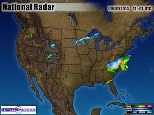
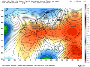
This sunrise was surprisingly frost free, especially as it was cloudless. Clear skies usually breed frost, but the wind was stirring around to the warm southwest, and the forecast was for those winds to pick up as a cold front approached late in the day. I had only three things on my schedule. Eat, rest, and a funeral for Elsie. I was glad it was mild, for I didn’t want to deal with shoveling frozen earth.
I felt ridiculously stiff and sore, like I once felt after serious work, though all I’d done the day before was hurry a little. Pneumonia left me amazingly out of shape, and had melted ten pounds from my scrawny frame, and I decided even hurrying a little must count as serious work, and be capable of making me stiff and sore. The net result was I didn’t even want to get out of bed, and when I made it to my armchair for a coffee, I didn’t want to get out of the armchair.
There are certain times in life when it is a heroic act of will to stand up, for example in the fifteenth round of a boxing match. There is a quitter in us which just wants to rest, and that quitter can be very persuasive, and one really needs to gird one’s loins to get up. However defying that quitter is what makes a champion get up in the fifteenth round and win the title match.
Also, incidentally, it sometimes is what gets an old man out of his armchair. This thought made me smile wryly. I might not be winning the title, but it was the only way I’d get any breakfast, as my wife had to rush off to run the Childcare all alone.
Though the fridge was full of Tupperware containers of excellent chicken soup, man does not live on chicken soup alone. Especially for breakfast. So I opened a can of corn beef hash, noting the 16 oz. can is now 15 oz. (“Shrinkflation”). I fried it up and then dropped four eggs on top. It was a big breakfast, but I have ten pounds to put back onto my scrawny frame.
It was delicious, and added more than a pound to my frame, but initially this consisted of a greasy blob in my stomach. My stomach informed me no energy would be available until it did some digesting.
When younger I could override this message from my stomach. Often I had to, for most bosses wouldn’t put up with me sitting around after I ate. So I’d trudge around working much more slowly than usual until the energy kicked in. But now I’m my own boss, and also seventy, so sometimes I see no reason to override the message from my stomach, and instead I just lay down.
In the morning Elsie would put up with about fifteen minutes of such nonsense, and then start to disturb my peace. She wanted to go out for a walk. Not that she would be so forthright as to bark at me. Instead she’d begin pacing about, clicking her toenails on the floor, and would increasingly talk to herself, sighing deeply and muttering odd noises. I knew I’d better get up, for if I allowed her agitation to pass a certain point her stomach would produce a sort of slimy bile which she’d vomit as a disgusting yellow pool on my wife’s floor. Nor would the dog clean it up herself. The prospect of such a mess nearly always got me up and out.
But now there was no Elsie. I could digest my meals longer than fifteen minutes, if I so chose. And the doctor had told me to rest. So I decided I’d lay down for a half hour, and closed my eyes, and…
…And abruptly it was more than two hours later. I couldn’t believe it. The clock must be wrong, but my cell phone stated the same time. I’d wasted an entire morning, accomplishing nothing but making corn-beef hash with dropped eggs on top, and eating it. Meanwhile my wife was running the Childcare all alone.
I supposed I could say the doctor had told me to eat and to sleep, so I had accomplished two things. Eating and sleeping. But a man usually does not like the sum total of his morning to be those two things. I paced restlessly about the house, and then headed out the back door and up the hill to dig a grave.
It wasn’t much of a climb, only around fifty steps, but by the time I reached the site I was winded. It seemed ridiculous, but was the after effects of the pneumonia. I was rendered a weakling, and leaned against the handle of the shovel to catch my breath.
I fumbled about in the pocket of my jacket to find the little gadget to clip to my finger. My O2 level was at 69% as I huffed and puffed, catching my my breath, but as I watched it rose back up to 85%, and I risked digging a few more shovelfuls. Immediately I was out of breath, and the gizmo showed my O2 level sink down to 64%. As I caught my breath I wondered how low I could get it.
As I leaned against the long-handled shovel it seemed obvious to me that it was going to take a long time to dig the grave, but that there were worse ways to spend a day than standing on a New Hampshire hill, admiring the view. It also occurred to me that Elsie was once again, for the last time, getting me out to enjoy a view I’d otherwise miss.
As I alternated between scooping a few shovelfuls and resting, I reminisced about all the walks I’d been on over fifteen years.
Originally we’d been more of a traditional town, where dogs ran free, especially on farms, but as houses popped up like mushrooms more and more people moved in who were downright offended by the sight of a dog running free, and Elsie often became the subject of Facebook posts by indignant Karen’s. They were convinced a dog off its leash was terribly neglected.
I didn’t want to tie her up, because the children at the Childcare delighted in her, and also we suffered an invasion of rats when a nearby stable shut down, and Elsie loved to hunt rats. She could snatch one from the weeds and kill it promptly with a good shake. Then she would cast it aside. Elsie ate nearly anything, but not rats.
However she also grew increasingly independent as she got older, and developed a habit of edging towards the bounds of the Childcare, and then abruptly bolting. She’d return in roughly ninety minutes, after making her rounds and investigating every compost pile in the vicinity. This made me more watchful, but that only made the dog more crafty.
They say you can’t teach an old dog new tricks, and maybe it wasn’t a new trick she was enacting. Maybe she had been free before, and was just stuck in her old ways, but she became increasingly devious about gaining her freedom, and famous on Facebook. Most people liked or at least tolerated her, but some grew quite angry. One person, (I fortunately never discovered who,) even tied her up and then began spraying her with a can of blue spray paint. She escaped by slipping her collar and bolting, arriving back at the farm looking abashed and like a blue zebra, but, (though she likely avoided that particular yard from then on,) she did not learn to avoid people grabbing her collar, for a few months later she arrived back from one of her ninety-minute escapades with a note attached to her collar. (The note made it clear that authorities would be notified if Elsie ate their cat’s food on their back porch again.) Besides getting me outside on mornings I was sluggish, Elsie also introduced me to neighbors I otherwise would not have met.
Increasingly I had to tie the dog up, but I did not like doing so, especially when I was working outside. I promised my wife I’d keep a better eye on her, because I just liked having a dog with me as I pottered about. This only increased Elsie’s skill at sneaking off. At times her ability to vanish as soon as I got absorbed in a task infuriated me, and I’d drop what I was doing, hop in whatever clunker I was driving, and drive to a place where I knew I could intercept her as she crossed a road. Long time residents would assist me, and I recall one woman, upon looking up from her beautiful flower garden and seeing me lurking on the street, cheerfully informed me Elsie was likely in her compost pile behind her garage. We walked together to peer behind the garage and sure enough, there was Elsie. What amazed me was that the compost pile was surrounded on four sides by chicken-wire four feet tall, but Elsie had managed to get in. The lady stated, “Oh Elsie! Are you ever grounded!”
And Elsie was indeed grounded. It was embarrassing to be seen lurking about, peering into people’s yards, attempting to intercept my straying dog. New residents to town were made nervous when they saw me.
I was determined to teach the dog to stay by my side. But in this case I could not teach the old dog a new trick. She would test doors to see if they were latched, and became an escape artist, learning new tricks other than the new tricks I wanted her to learn.
One unexpected trick she learned was how to get people to pamper her. Besides being yelled-at and spray-painted blue, she also met a fair number of kindly people in her wanderings, and was at times fed by complete strangers. I wasn’t there and don’t know the details, but I do know she developed a pathetic expression she used on susceptible people. A posting would appear on Facebook, wherein someone would ask, “Does anyone know who’s dog this is? The poor thing was lost, and came wandering into my yard half starved to death.” Then there would be a picture of Elsie, wrapped in a blanket of lamb’s wool and eating what appeared to be sirloin steak. A flurry of replies would then follow, informing the kind person, “That is Elsie.” Then I would hear about it from my wife, (because I myself am never on Facebook). And I’d go pick her up.
One morning I had to fly out the door because a cellar was flooding over at the Childcare in a terrific rain, but Elsie whined she hadn’t been for her morning walk. I couldn’t find the leash, but in heavy rain I could usually let her into the backyard and she’d return swiftly. However on this morning a cottontail hopped across the back yard, and a rabbit could make Elsie forget her age in an instant, and she went bellowing and crashing off into the woods. Swearing softly to myself I headed off to the emergency at the Childcare. Even before I got the sump pump going my wife informed me from above that a Facebook post stated Elsie was in safe hands. As I emerged from the basement I inquired, “Where is she this time?” My wife informed me, “The bank.”
I happened to need to make a deposit that morning, so it was actually handy Elsie was at the bank. As I walked in all three tellers looked at me with sympathetic eyebrows. They informed me Elsie had come dragging out of the woods completely drenched, and covered in burrs, and had staggered to the drive-through window and looked up with her pathetic expression. Now she was behind the counter, where I am never allowed to go, getting treated better than that bank ever treats me. She was swaddled in towels and had a large bowl of kibble in front of her that they’d rushed off to buy from the market across the street. I shook my head. I briefly explained the dog had spent less than forty-five minutes in the rain, after running off after a rabbit, after a good breakfast. My voice got a bit lame towards the end, because all three tellers were regarding me as if I were a person making poor excuses after maltreating his dog.
As Elsie grew older she developed her pathetic look to a high art, and could stop cars. I think she may have even exaggerated her arthritic limp a little, to make it more effective. (I know there was no sign of a limp when she saw a rabbit.) I had several opportunities to see her in action, for, despite the fact we increasingly had to obey the leash law, and she was increasingly banned from the Childcare and reduced to four short walks a day, (after breakfast, noon, before supper, and before bed,) I still liked to have with me as I huffed and puffed splitting and stacking wood by my house. On those occasions I’d keep an eye on her, and sometimes watched her walk to the end of the drive, sit down, and look pathetic. I saw cars slow as they passed. Some stopped down the road, and returned in reverse, and they’d open their passenger-side door, but, before Elsie could jump in, I’d shout, “That dog is mine!” Then I’d wave, the kindly person would wave back, and Elsie’s plot would be spoiled, but she never lost hope nor stopped trying.
Sometimes she succeeded. Usually it was when my grandchildren were visiting, and she was playing with them. They’d stop for a snack, and Elsie would be offended she received no snack, walk to the foot of the drive, look pathetic, and hop into the first car that stopped. The first thing I’d know about it was when I heard there was a Facebook post showing her enjoying a sirloin steak in front of a fire in some lavish living-room in some million dollar mansion. (Perhaps I exaggerate, but only slightly.)
Then came a frightening day when she vanished and there was no Facebook post. I had a sick feeling the foolish dog had jumped into the wrong car, as I went to the police station to find out if they had heard anything. The secretary was sympathetic, because she knew Elsie, and shook her head, as she shuffled through the overnight notes. Then she paused and smiled at me. A newly hired officer, who did not know Elsie, had advised a kindly person who had picked Elsie up to take the dog to the regional office of the humane society. I called them up, and they informed me they had her. They were located across the state in Swanzey, more than a half hour drive away. Off I eent.
The people in Swanzey were very nice, and we laughed over Elsie’s ability to get rescued from her own driveway, but once in the car Elsie got a frown. I had better ways to spend my time.
Perhaps the most ridiculous rescue was when the newly hired officer picked Elsie up from my drive even as the grandchildren played in the back yard. He told me a leash law was a leash law, as I paid the $25.00 fine up at the station. The secretary carefully avoided meeting my eye.
In any case, the town changed and dogs definitely didn’t run free any more. I became a grouchy anachronism, voicing garrulous opinions about the direction society was headed, and Elsie became a dying breed, the last of the free dogs.
She still was allowed freedom when I took the goats out to the flood control reservoir behind our Childcare. Originally there were many goats, as well as many small children. Elsie, a mutt with some retriever blood, also displayed some herding ability at times, and developed a relationship with the goats which fascinated me. My fascination grew, even as the herd dwindled down to a single goat.

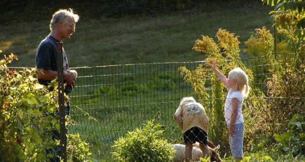
Above is a picture of Lydia, looking backwards for Elsie, my last goat looking for her nemesis the dog, after the dog had its last swim.
After that last swim the dog began yelping, because she was so tired she couldn’t push her way through the especially thick grass (due to the summer’s extravagant rainfall) to the top of the dam. I had to walk back and huff and puff down the embankment to break a path for the weary, old dog. Elsie gave me her pathetic look, but I wasn’t going to fall for that, and refused to carry her. But it was obvious we were both much older, as we reached the top of the dam. Elsie was dragging and I was huffing and puffing.
Lydia gave us both a somewhat condescending look. She didn’t hold with having anything to do with bodies of water larger than a puddle. Arid-land creatures, goats rival camels with their ability to endure parching circumstances, and, after I stopped milking her, Lydia amazed me by going days without touching her water bucket, seemingly getting by merely on the dew on the grass she ate at dawn. However she would have nothing to do with the flood control reservoir, never drinking from it, nor wading even ankle deep. The fact Elsie loved to swim in it always caused her to wear a look of disbelief, turning to mild panic when, as a younger dog, Elsie would rush up to us and then shake herself vigorously, filling the air with spray.
The two beasts had been juveniles together, and then endured each others company for fifteen years, as the herd grew to seventeen, and I felt rich, and then as it shrank to one, and I felt poor again. As their ancestors had been predators and prey, they had many reasons to dislike each other; one liked meat and one was vegan, (which seems to be a reason many humans dislike each other as well). However their ancestors had been herders and herded as well, so they also had an ancient linkage, though I doubt either would begrudge confessing any such attraction could ever exist.
One thing I never saw them do in fifteen years was to touch noses. It was a common greeting among dogs, and among goats, and there were occasions when I sat looking at clouds and composing poetry when a goat, or my dog, might come up and touch noses with me, but they simply would not do it with each other. It simply was unthinkable. Yet they were strangely attached in other ways. Should a distant branch snap, off in the woods, the goats came rushing to me and my dog, as the dog took a few steps in the direction of the snap, lifted a paw, and freed an inquiring “woof”.
One bond I felt we might have was we were all social animals. Goats have their herds, dogs have their packs, and humans have their small towns or city neighborhoods. There is enough similarity to make partial blending possible.
Not that they didn’t constantly test each other. If a goat became too complacent the complacency may have seemed disrespectful to Elsie, and she’d make a totally unnecessary move, more like a feint than a lunge, towards the tendons of the goat’s rear legs or the goats udder, and that would wake up the goat in a hurry. Usually the goats pranced away from Elsie, even as she wandered by completely disinterested, as if she was a wolf in their midst, which, when you think of it, she truly was. But at times Elsie became a sort of air-headed wolf, so lost in her sniffings she neglected her duties, and I think this must have seemed like negligence even to the goats, for why else would one reach out their herbivore mouth and pull the dog’s tail? Elsie would then wheel and deliver a bombastic lecture of barks and snarls and bared teeth containing every swear-word a dog knows, and the goats would all back away, looking at each other with marveling expressions, apparently very impressed. (But in a strangely pleased, admiring way.)
Watching this strange relationship over fifteen years, and also understanding I was a part of the mix, gave me ample time to reflect upon the strength that comes from differing talents working as a unity. (I could go off on a very long tangent at this point, but just the basics will suffice).
Dogs have amazing noses. They can literally “see” who passed over a patch of earth, and gauge how recently. Only when there has been a thin fall of powder snow can we see the footprints, and get a small idea of the newspaper they are reading when they snuffle over a patch of earth. But furthermore, they read moods. An angry man can falsify a smile all he wants, but if he approaches a child a dog has custody of, the dog bares its teeth.
Goats have amazing eyes. I’m not sure how their square pupils work, but when my herd stopped and all looked in one direction, I too stopped to see if my dim sight could see what they saw. Often I couldn’t, but when I could it amazed me because the only reason I could see was because brown or rust-red fur clashed with green leaves, and goats are supposedly color blind and shouldn’t be able to see such a clash. On one occasion it was baby foxes playing under a low-hanging branch of a bush, mere tiny red specks in the distance. I never would have seen them, had not the goats alerted me.
Often I was humbled, because I lack an amazing nose or an amazing pair of eyes. What’s amazing about me? Nothing, really, except for the fact I’m in charge. I’m the boss, though the beasts do like to see what they can get away with. And I feed and protect them. When the goats escaped and ate the neighbor’s roses, I was the one who made amends. When the dog was at the police station, I bailed her out, paying the $25.00 fine. I’m not sure how amazing that is, but for fifteen years I was the overseer of something not seen very often in modern suburbs. Just a ripple in the waters of time.
I leaned against the long handle of my shovel to catch my breath. It was just my luck to hit a large stone in the usually stone-free hillside, but I’d finally budged it. I put the little clip on my finger and saw I’d set a personal record. 49%! At the hospital alarms would probably be going off, and nurses would be scurrying, but for a tough old Yankee like me, it just meant I’d huff and puff a little longer.
If I did die, it would be with my boots on, and I preferred that to being in a hospital with a ventilator jammed down my throat. Or to be dying with my pants down. Going to the toilet is stressful, and the night before I’d had the little clip on my finger as I evacuated my bowels, and was surprised to see the stress lowered my 02 levels to 56%. Who wants to die with their pants down when they can die with their boots on? But I was being too morbid, even as I attempted humor. Elsie deserved better.
I trimmed the edges of the hole, and the grave was done. I was exhausted. I decided I needed a strong coffee before the burial, and headed down the hill to the coffee pot and my armchair by the fire. I couldn’t resist checking the news, and as usual it was abysmal. Terrorists beheading children, and so on. It occurred to me that, while some wonder if dogs have souls, the question should now be whether humans have them.
In this fouled world, not worth the cheap tintype
It's minted from, the death of a dear old dog
Deserves some blink. Maybe not tears to wipe
And hide from reluctant lashes, nor fog
On the teeth of dawn, but at least a pause
In the never-ending yammer. We're made cold as ice
By the symptoms of survival; the cause
Of cold is its continuation. A nice
Sunbeam might warm, but warming makes no sense
In this gyre with no heart. A black hole cores
Our galaxy. Who in their right mind repents
The death of a dog? It's low spirit soars
While where can we claim our high spirits go?
A dog's death reminds the highest they're low.
The strong coffee must have included too much cream, for I nodded off in my armchair, drifting off into a strange reverie wherein I thought I should have been born a Buddhist. They believe the one life we live is far longer than the three score and ten years allotted by orthodox Christians, and in fact that single “life” included numerous, (perhaps millions), of incarnations, including animal incarnations before we achieved “God’s own image” status as humans.
Therefore dogs do have souls, striving to become human. Humans, however, fail to grasp what Creation is for, and all too often strive to be dogs. Rather than seeking their birthright, and becoming children of God, they backslide, so addicted to Creation they prefer it to their Creator.
Therefore dogs are, in a sense, superior to humans, for they are striving towards God, whereas humans are lollygagging about, treading water at best and devolving at worst. And if you doubt this, ask yourself this question, which I ask myself: Given the choice, would you rather study scripture or watch men run about in shorts bouncing a ball and shooting it through a hoop? For most of my life, given the choice of watching a basketball game or attending a Bible study, I confess basketball would have won every time.
An odd thought occurred to me as I drifted into dreaminess. It was that, whereas physical, Darwinian evolution forces each step to closely resemble the gradation that preceded it, spiritual evolution might escape such limitations, and beasts might reincarnate as whatever seemed most interesting, and therefore Elsie might reincarnate as a rabbit, or even a goat.
Abruptly I woke with a jolt. I glanced anxiously at the window, afraid it would again be dark, but was glad to see it was still golden. I then lurched my aching body to my feet and headed out to bury the dog.
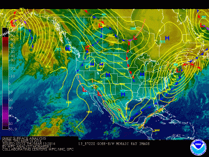
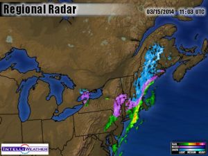
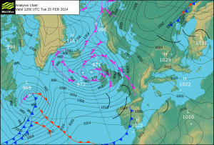
It was a strange afternoon for late November, especially after so much wet weather. The approaching cold front wasn’t just ramming into our local, sodden air, but had peeled a ribbon of very dry air from some place out west, either the deserts of Arizona or the Chinooks of Alberta, and this air was so very dry the wet leaves swiftly dried and began to stir and then to rush about my feet. I thought at one point they might fill the grave, but they didn’t. I again thanked Elsie for getting me out to see weather I otherwise would have missed.
How often she did that. Too often I grumbled. But the dog dragged me out, and how many sunrises did I see and how many bird songs did I hear? How much weather did I sniff even as she sniffed? I recall at least two rainbows I would have been oblivious to, plus night owls that hooted and packs of coyotes that yipped, and much more. (Not to mention that I often needed the exercise).
As I lifted Elsie from the back of the Jeep I was afraid she’d be heavy. Towards her end she couldn’t leap into the passenger seat of the Jeep any more, and I’d had to hoist her bulk. But she hadn’t eaten much towards her end, and was surprisingly light. Rigor mortis made her stiff as a board, but fortunately she was in a position of rest, and fit in the hole I had dug. I stood a while trying to think of some profound eulogy, but couldn’t think of much beyond, “Good dog.” Then I covered her with an old sheet my wife donated, and filled in the hole.
And that was that. I knew it was inadequate, but I suppose we always must be inadequate, when trying to thank something as huge and beautiful as life. But at least I hadn’t “disposed” of her.
Next I had to attend to a hoard of grandchildren arriving for Thanksgiving, and how we were going to maneuver a mother-in-law with dementia through the event. I figured the dog was done with, but she wasn’t. As many old country songs croon, to fill the hole of a grave does not fill the hole in your heart.
In a fall already full of losses
My old dog died. The children felt the space
On Thanksgiving, yet bore their small crosses
But a moment before filling the place
With fresh glee. The sweet stampeding patter
of small feet; the abrupt outrage over
The ownership of a toy: a matter
just as abruptly forgotten; a blur
Of feeding, dishes, diapers, wiped quite clean
The slate of my mind from all morbid thought
Until with shrill goodbyes they left. I had seen
Such chaos that to step in a hushed house ought
Be welcoming, and yet I bit my lip.
No dog's tail greeted me with "tip-tip-tip."
