
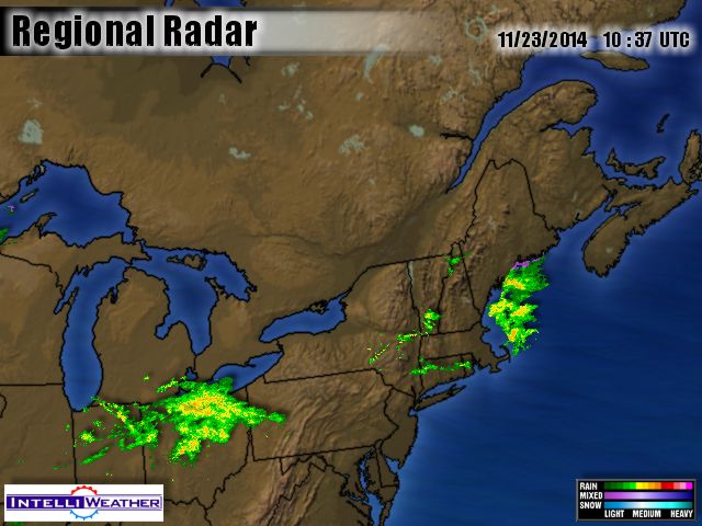
Temperatures have risen overnight, as we get a brief breather from winter weather. As the cold high pressure sags out to sea to our south milder air is swung north on its west side and east over its top, and it is ten degrees warmer in Northern Vermont than down in Virginia. (41 degrees in Burlington versus 31 in Roanoke.) (+1 vs. -5 Celsius). The radar shows nothing but sprinkles of rain, and no northern snow. It is colder in Washington DC than up in New York and Boston.
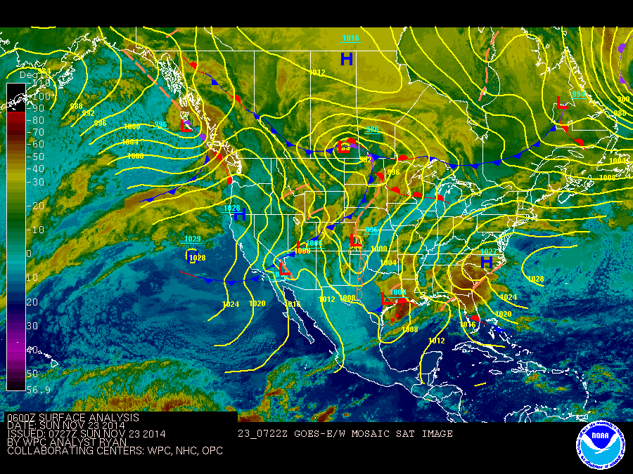
One breathes a sigh of relief in the mild, predawn darkness, but worry wonders where the cold has gone. It obviously is to our south, being warmed by southern landscapes and a the Atlantic’s Gulf Stream, as reinforcements must be gathered to our north up in Canada.
I like to look upstream to Calgary for hints about our future, and yesterday the Blogger Stewart Pid alerted me to a snow event they were seeing pop up on their long-range charts. So I look that way. (I hope this works)
That is the forecast for Fernie, up in the Rockies southwest of Calgary. The snow-event is not quite as big as it appeared in yesterday’s forecast, but a possible 34 cm of snow is nothing to ignore, and I can also see their mild weather will be ending. The reinforcements of arctic wolves will be heading south.
But will the howling wolves just head south to Texas in the west, as mildness surges north here in the east? The models are showing a low heading up from the Gulf of Mexico towards the Great Lakes, and that would seem to keep us on the warm side. However, just as mild air can surge east over the top of a high, as it is doing this morning, cold air can surge under the bottom of a low, next week. Too often I’ve watched mild air come towards New Hampshire, only to be lifted off the ground up into an occlusion aloft just before getting here, to count on any real warmth actually arriving.
Also, when a cold, arctic high pressure moves out over the Atlantic, as is happening today, it is sort of like the lid on a pressure cooker. The warm water wants to billow warmth up like a huge hot air balloon into the cold air, but the descending air in the high pressure keeps it clamped down. It is as if the balloon is tethered down, and then, as the high pressure moves off shore, it is like the tether was chopped with an ax. Abruptly the air rises and abruptly you have a storm off the coast, just in time for Thanksgiving.
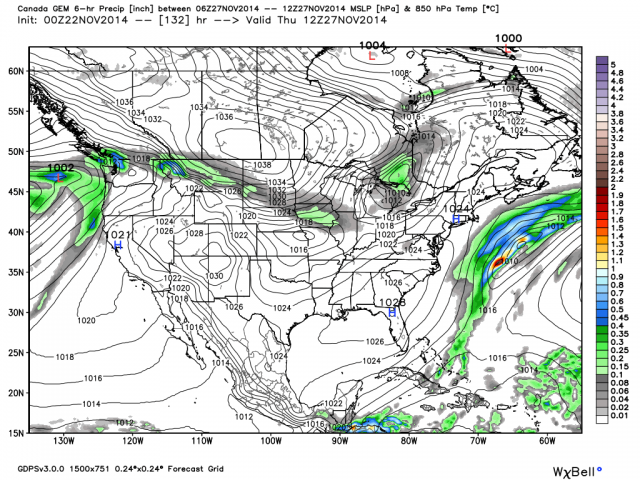
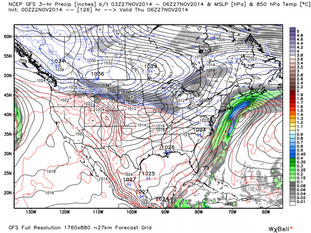
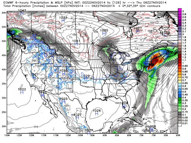
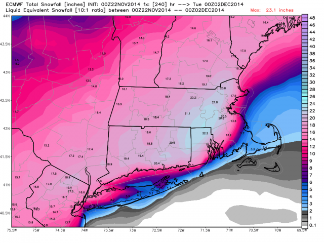
So I go to the Weatherbell site to see what Dr. Ryan Maue’s maps say, and immediately see that, as usual, Joseph D’Aleo is miles ahead of me, and has already done all the work on his blog’s post. He shows that GEM (Canadian) GFS (American) and ECMWF (European) all see the Thanksgiving storm, but have hugely different solutions.
The GEM sees the storm slipping harmlessly out to sea.

For short term weather the best site is nav Canada. They are updated every 6 hours. They presently show a tough along the eastern Rockies with a low developing N of Edmonton this evening and moving out at 15 knots and increasing to 20 knots after midnight – an Alberta clipper. There was another system that developed on Friday in the same place, and it is now providing freezing rain in northern Ontario.
Go to:
https://flightplanning.navcanada.ca/cgi-bin/CreePage.pl?Langue=anglais&NoSession=NS_Inconnu&Page=forecast-observation&TypeDoc=html
Click on Graphical FA then select Prairies
Thanks. I’ve had a good time exploring that site. I’m not used to the pilot’s-eye-view of various levels of the atmosphere, but I think I could learn to like it. It seems quick and simple, and something you can digest in a hurry. I don’t always have time to study all the details of other maps.