
Our three on-the-scene adventurers out on the Beaufort sea in an iceboat-catamaran continue to gravely worry me, and also to send us remarkable news involving thin ice and polar bears.
Labor Day weekend’s news was that a polar bear had come right up to the cockpit of their craft, which is tiny and close to the ice-surface. They had a few seconds to take a picture of the bear (polar bears can weigh up to 1600 pounds), from ten feet away, but decided to heck with journalism. Sebastian went for pepper-spray as Vincent went for a flare. A blast of pepper-spray sent the bear galloping away, dropping every now and again to rub his face in the snow. The bear likely will stay clear of iceboat-catamarans from now on, equating them with skunks. But sadly they took no pictures, and, (as we tend to be skeptical at this site), we will take them at their word with a grain or two of salt, knowing how old salts, and also young salts, tell tales.
Fortunately the next day they came across a mother bear with her two cubs, and this time could take pictures.

Vincent stated the cubs looked chubby but the mother “thin”, (which I imagine is to be expected, as it is largely her milk that makes the cubs chubby). I do know, without imagining, that a mother bear is nothing you want to mess with, when she is guarding her cubs, and this particular mother does not look entirely pleased, in the above picture (nor all that “thin”.) Perhaps Vincent stated she looked “thin” because that can be a way to flatter females, and kept him out of trouble. As usual with adventurers, ignorance is bliss, or they never would have ventured into their adventure in the first place, and instead would have stayed safely at home. When it comes to whether the mother bear is thin or not, Vincent is likely on thin ice, for I doubt he is qualified to judge. He likely should ask a zoologist like Susan Crockford. But, as an adventurer, he has dared tread on thin ice….until last week.
Last week, perhaps because he was only roughly 40 miles from land, and that much closer to all the problems involved with dealing with something he hasn’t had to deal with in months, (namely filthy stuff called “money”), Vincent’s comments abruptly became politically correct, like a person instinctively genuflecting, fearful of the thin ice of offended patrons.
“Ps: when I see beautiful animals like this in their natural habitat, I feel very fortunate. One question remains in my head though. Why aren’t we seriously taking actions to reduce our carbon footprint and better control the warming temperatures of this beautiful planet.”
Considering his ship seems to be largely made of petrochemical plastics, and heat and cooking involves propane (and not the visible solar cells) Vincent seems a bit of a hypocrite, for a wooden ship would have had a smaller “carbon footprint”. Furthermore, the mix of open water and sea-ice he and his two shipmates have experienced seems not to be evidence of “Global Warming”, and instead very much like the conditions glimpsed by an early Nimbus satellite picture of the same location from the same time of year, 49 years ago:

I suppose we should not wonder at how such an obvious photograph of fact can be ignored. History seems to involve as much erasure as it does notation. (Time to rave.)
For example, the greatest navy the world has ever seen (in terms of numbers, not tonnage,) is not the USA’s current fleet, nor was it the 600-ship-navy Britain assembled to defeat Napoleon. Rather it was a fleet of over 3000 ships, established by the Chinese genius Zheng He, starting in the early 1400’s. It included ships over 400 feet long and 150 feet wide, that towered over Europe’s puny ships. However a certain political faction in China felt such expense was too extravagant, and these politicians not only cut the Chinese Navy’s budget, but did their best to erase all records of what this great Navy had accomplished, including all discoveries made by China in the 1400’s. They eventually made it illegal for a ship to have more than two masts. By the 1600’s China had gone from being the world’s greatest naval power to basically having no navy at all. In an effort to disguise these signs of the weakening of the Ming Dynasty, further censorship saw that all exploits and discoveries made by China were expunged from the record. (The Ming bureaucrats were “hiding the decline”.)
We might not even know these huge boats existed, were not for the fact the people in India and East Africa were awed when the giant ships and enormous “treasure fleets” showed up, and they described China’s prowess in non-Chinese records. (Also, because some anti-navy bureaucrats in China wanted to brag about the mighty navy they had destroyed, a few facts and figures leaked into Chinese records even as they attempted to deny the past. However there is much we don’t know.
What-we-don’t-know is basically lore, involving places this huge fleet “might” have sailed, (especially as they fell out of favor in the imperial court in China, and became renegades and even anti-Ming pirates.)
Lore item #1: The Chinese had no reason to stop exploring on the east coast of Africa, and may well have continued exploring around the Cape of Good Hope and up the west coast of Africa, and even visited Portugal. There are some unfounded but very old reports of the Chinese visiting Lisbon. This visit may have prompted the concurrent Portuguese desire to explore the other way around the Cape of Good Hope. (Before the 1400’s Portuguese sailors felt the world fell off a cliff in that direction; their square-rigged ships could sail off downwind in that direction, but could never return, because such ships could not battle their way upwind, and therefore there was no reason to sail to doom in that direction, until they developed their version of the lateen sail and could fight their way upwind.)
Lore item #2: In the early 1500’s there was much gossip among Spanish sailors about the “Northwest Passage”, but at that time it was called the “Strait of Anian”. As early as 1507 the “Waldseemüller map” shows North and South America separated from Asia, with a hint of Bering Strait.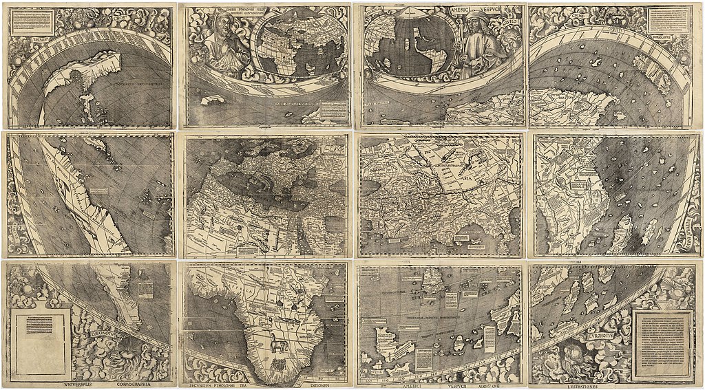
The existence of this map is odd. Why? We have no records of “official” explorers up in Bering Strait. The Portuguese were not “officially” in Malaysia in Malacca until 1511, and did not “officially” reach as far north as Japan until 1543 (aboard a Chinese ship.) Magellan never entered the Pacific from the east until 1521. So how in the world was the Waldseemüller map produced in 1507?
Welcome to the wonderful world of lore. As you navigate these treacherous waters and walk this thin ice, you are confronted with not only the denial of history, as occurred in China, but also by the “fake news” of people trying to prove that a fool and his money are soon parted, which is also called, by businessmen, a “prospectus”.
It takes a lot of hard work to save the money to buy a ship, and few who work to get their own boats stupidly gamble their ships. However the prospect of getting rich quick, or getting richer quicker, is called “risk” by businessmen, and a fast-talker was always trying to get a rich boat-owner to part with his money and gamble his craft, calling the risk a “sure thing”. And what was the temptation? Well, it is hard for us to imagine the value of spices at that time.
(For example, with Visgoth barbarians at the gates of Rome, the Pope, as a go-between for emperor and barbarian, arranged a ransom for the city, and the ransom included big sacks of pepper.)
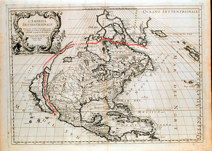
Next time you hold a pepper shaker, ponder the fact wars were fought over the stuff. Also trade routes to the pepper, and control of those trade routes, (and therefore exploration), were hugely important. If you were a fast-talker, you might trick some big bucks from men who pinched pennies, with a map of a shorter trade route, such as the “Strait of Anian.” Some of their fast-talker-maps show the Gulf of California as the Pacific exit to an Atlantic entrance marked by the Gulf of Saint Lawrence.
We may now laugh at the people who bought such inaccurate maps. But we forget something crucial. Very real men set sail. And they used such maps. Yowza! What sort of debacles might you find yourself in, using such misinformation! Some never returned. Yet some did return, against all odds. And they improved the maps. But even by 1687 the “improved” maps were amazingly incorrect.
The lousy maps, (and the fact some of the fast-talkers were tried and convicted of being con-artists), tends to make some completely dismiss all lore. This is an over-reaction, and fails to appreciate the sailors, ill-advised by such maps, who somehow managed to survive the debacles they sailed through, and advanced our wisdom. I am careful not to dismiss their accounts of survival as “fiction”, even though I am by nature a skeptic.
For example, there is lore that speaks of a Spanish sailor, “Bartholomew de Fonte” penetrating the Northwest Passage from the west in l640 and meeting a trader from Boston, “Captain Shapely”. Pass this information ahead through the mists of a century, to government officials, and you wind up with an official map, and also a very good reason Sebastein and Vincent have been frustrated in their attempts to cross the Pole. Obviously they have been stopped by “the nation of dwarfs”.

To end this long sidetrack, the fact Francisco de Ulloa could produce a (in some ways superior) map 250 years earlier in 1507 likely has nothing to do with the primitive nature of Europe’s knowledge, at that time, but rather has everything to do with sailor-to-sailor conversations with the highly advanced Chinese, even as the Chinese authorities zealously attempted to abolish their advancements, and erase all memory of “The Strait of Anian” .
Lore item #3: In my study of my neighborhood as a young man, I came across mentions made by the first settlers of Boston, when they lived in Charlestown, (six years before Boston itself was settled), of a rotted ship, a ruin that was a local landmark, (called “The Somerville Hulk”, as I recall). It was noteworthy, as an aside in the early 1600’s, because the spongy wood of the very old shipwreck was so much bigger than any English ship, so it was assumed to be Spanish. Around thirty years later I chanced across a blogger who knew about this obscure trivia, and who stated the “Somerville Hulk” was even larger than any Spanish ship of that time, and therefore must have been a Chinese junk. That whetted my interest, and I started to look in modern records, but to my disappointment I can’t find any evidence the “Somerville Hulk” ever existed, searching modern computers. Unless some Chinese artifact dating from 1475 turns up as they dig the cellar hole for a modern building in Somerville, this information must remain in the misty landscape of lore.
The reason lore has value is because it often has some tidbit of historical trivia at its core, and often this mere iota of fact represents something that makes accepted history become a story that simply “doesn’t add up.” Like a suspicious detective listening to the alibi of a suspect, we become aware that history has a certain “spin”, and may stray from the Truth, the whole Truth, and nothing but the Truth. Certain declines are hidden, certain warm periods are erased, and certain shady deals are glorified into a prospectus. A certain national egotism arises, in a my-Dad-is-better-than-your-Dad manner, so that most nations tend to think civilization began with their ancestors. Egyptians feel it began with them, while Persians feel it began with them, (and they have been fighting about this since back to before it was noted by hieroglyphics). (Meanwhile Poles beg to differ. Civilization began with them.) (And Romanians feel they represent the longevity of the Roman Empire.) As absurd as such vanity may appear to outsiders, it seems a necessary evil, a construct without which nothing gets done. Ancient kingdoms attracted fierce loyalty, and their egotism led to success, and they erected bragging monuments to their power, which now are ruins in a wasteland, dust in the wind. This doesn’t mean they were not the movers and shakers of their time. But it does mean that you need to take their history, as their historians recorded it, with a grain of salt.
And what was true in the past is likely going on in the present tense. But perhaps it is especially obvious now. We are more aware of “Fake News” than people of the past were, because “Truth In Advertising” seems to have hit an all-time-low. “The buyer beware” has expanded beyond the marketplace. Skepticism has become necessary armor, and churches have grown so hypocritical that the word “faith” is often deemed synonymous with the word “chump.” But one shouldn’t throw the baby out with the bathwater. A wonderful quality of Truth is that it remains true even in the company of liars. You can ignore Truth all you like, but it remains there, looking you in your averted eye with the steadiness and inevitability of death.
Our three adventurers out on sea-ice are facing a Truth most can ignore, and that is that one false step could end everything. (The same is true while driving during the rush-hour on a freeway, but most drive it out of their minds.) (Our three adventurers know political correctness doesn’t mean all that much, when a 1500 pound polar bear is grinning in your doorway.)
Meanwhile I sit in safety far away, able to study the course of history and come to profound conclusions. And I conclude this about the salvation of mankind: It all depends on pepper. Just as the sack of Rome was called off in 410 when three men (Pope Innocent, Emporer Honorius, and Alaric the Visigoth) agreed to a ransom including 3000 pounds of pepper, three men on the arctic sea-ice negotiated with a polar bear in 2018, and pepper again proved to be crucial in their negotiations. Therefore it is only logical that pepper, and not CO2, is what tips the climate from cold periods to warm periods.
In some far distant future, after a computer-virus erases all our records and mankind is left with only scraps of yellowing paper with which to judge our modern motivations and our modern deeds, hoary historians may chance upon the above paragraph, saved due to some fluke of fate, and take it far more seriously than I ever intended it to be taken. They will scratch their heads and sagely stroke the bristles of their beards, pondering the deep profundity of my whimsy, as we ourselves melt into the mists of lore.
For there is something about men that is prone towards distortion. Temperatures are noted down, but then must be adjusted; a Medieval Warm Period must be erased. Men are called heroes and statues erected, but then the same statues are toppled in disgrace. Even Solomon in all his glory sighed, “Vanity of vanities! All is vanity! What does a man gain from all his labor at which he toils under the sun? Generations come and generations go, but the earth remains forever.” All rewriting of history, revision after revision, only leads to further dissatisfaction and disillusionment, wherein all excuse-making and telling of the Big Lie is tantamount to moving about political and religious furniture, not much different from a dog chasing its tail. Truth seems to have no solidity, and then a polar bear grins in your door. Suddenly you remember what Truth is. It is pepper spray.
That’s the great thing about Truth; it exists in the present tense, not in the musty, old sanctuaries of musty, old churches, where musty, old priests wearing musty, old robes enact musty, old rituals by rote. Even the beautiful poetry of musty, old psalms state that Truth is not far away and musty and able to be warped and revised by politics; it is standing right next to you with a hand on your shoulder.
Our three sailors have been facing such a present-tense Truth as they have battled towards land. They may never reach the hot shower they dream of, when a bear may dispatch them with a single swipe of a massive paw, or sea-ice may grind them without mercy. The politics of Global Warming matters less than the next mile, with winter coming on and the days shortening and the plastering snow sticking to their craft.

Their drone gives them beautiful shots for a future docudrama, but also shows less open water ahead. The current pattern has blown the colder air to their side of the Pole, and there is less open water, and more areas where the refreeze has already begun.

They prefer the open water, or the flat pans of ice, but are facing a sort of mountain range of pressure ridges as they approach Banks Island. Thy have discussed moving around the southern edge, in the hope of finding more open water, but the water may be slushy now.

When the wind turns against them they have to anchor the boat on the ice to keep it from being blown over the ice. Fortunately the wind has been with them most of the time, and the ice drifts the right direction even when they rest. However this drift can build pressure ridges, and close the desired areas of open water.

One unnerving event has been the refreezing of meltwater pools, which then are lidded by thin ice that can give way as they strain to haul the boast, which weighs roughly a quarter ton.

If they break through the water can be chest deep, (and some melt-water pools have no bottom, though they haven’t described one of these yet). Fortunately they have “dry-suits”, which would keep them floating if they plunged into water above their head, and keeps the salty ice-water (which is below the freezing point of human blood) from causing nearly instant hypothermia, and often death within five minutes. Increasingly they are slowed by slush.


The closer they get to Sachs Harbor the slower the going has gotten. Last report had them within twenty miles, but struggling all day had moved them only five miles.
They see bears every day, and are in danger. Prayers wouldn’t harm them any. The scenery is less summery and more stormy and cold. Among less-than-beautiful views of nature they’ve seen was a young, dead male bear in an area of bloody snow, likely killed by an older male. No picture of that. (Likely a territorial dispute, and more of a sign of over-population than of bears going extinct). I hope they reach land safely and also make a bundle with their docudrama.
The pictures they share certainly give one a very different impression of the sea-ice minimum than sitting at a computer does, looking at this graph:
I reiterate that this graph utterly undermines the theory of sea-ice being in a “Death Spiral”. Such a spiral is suppose to feed on itself and has no reverse gear. The ice could not have done what it has done, which is to increase from last year’s totals in extent and volume. (2017 to left; 2018 to right)


Stay Tuned.
UPDATE: They made it! (See comments.)

A wonderful weave of past, present, lore, and thought. There is so much I could comment on, but I will limit it to just this – the “Waldseemüller map”. When you really look at that map, Caleb, and consider what Earth looks like from space, the drawing of the Americas almost looks like what you would see if you were perhaps a 1000 miles above North Africa, and could see them on the left edge of the globe, although they should be a bit wider, and the way Asia tapers towards Alaska on the right rim gives a perspective view as well. It fascinates me that the map truly tries to show the round world on a flat sheet, at a time when there wasn’t that much faith in it being round.
I was also fascinated with the accuracy of the second map from about Massachusetts north, including Labrador, Greenland, and Hudson Bay. Considering they had no downward perspective of the land from any height at all, to even grasp the contours of the coast lines really shows remarkable imagination. Here again, it looks like there is an almost visual impression of a round planet tapering off to the east.
I noticed that too. Do you suppose they levitated?
Actually the skills surrounding map-making were crucial to survival. Also I think captains kept lots of knowledge in their heads, even when they had no maps. They would describe how the land looked from the sea, to each other. If they didn’t have an uncanny skill in “visualizing” they were sunk.
Glad you enjoyed my rave. Sometimes I enjoy just letting my mind wander where it will.
Re the didn’t have much faith in the earth being round ….. the smart folks had known the earth was round for a long time …. look at the circumference calculations by Erathosthenes https://en.wikipedia.org/wiki/Eratosthenes
Measurement of the Earth’s circumference
Illustration showing a portion of the globe showing a part of the African continent. The sunbeams shown as two rays hitting the ground at Syene and Alexandria. Angle of sunbeam and the gnomons (vertical pole) is shown at Alexandria, which allowed Eratosthenes’ estimates of radius and circumference of Earth.
Eratosthenes calculated the circumference of the Earth without leaving Egypt. He knew that at local noon on the summer solstice in Syene (modern Aswan, Egypt), the Sun was directly overhead. (Syene is at latitude 24°05′ North, near to the Tropic of Cancer, which was 23°42′ North in 100 BC[16]) He knew this because the shadow of someone looking down a deep well at that time in Syene blocked the reflection of the Sun on the water. He then measured the Sun’s angle of elevation at noon in Alexandria by using a vertical rod, known as a gnomon, and measuring the length of its shadow on the ground.[17] Using the length of the rod, and the length of the shadow, as the legs of a triangle, he calculated the angle of the sun’s rays. This turned out to be about 7°, or 1/50th the circumference of a circle. Taking the Earth as spherical, and knowing both the distance and direction of Syene, he concluded that the Earth’s circumference was fifty times that distance.
His knowledge of the size of Egypt was founded on the work of many generations of surveying trips. Pharaonic bookkeepers gave a distance between Syene and Alexandria of 5,000 stadia (a figure that was checked yearly).[18] Some historians say that the distance was corroborated by inquiring about the time that it took to travel from Syene to Alexandria by camel. Some claim Eratosthenes used the Olympic stade of 176.4 m, which would imply a circumference of 44,100 km, an error of 10%,[18] but the 184.8 m Italian stade became (300 years later) the most commonly accepted value for the length of the stade,[18] which implies a circumference of 46,100 km, an error of 15%.[18] It was unlikely, even accounting for his extremely primitive measuring tools, that Eratosthenes could have calculated an accurate measurement for the circumference of the Earth. He made five important assumptions (none of which is perfectly accurate):[18][19]
That the distance between Alexandria and Syene was 5000 stadia,
That Alexandria is due north of Syene
That Syene is on the Tropic of Cancer
That the Earth is a perfect sphere.
That light rays emanating from the Sun are parallel.
Eratosthenes later rounded the result to a final value of 700 stadia per degree, which implies a circumference of 252,000 stadia, likely for reasons of calculation simplicity as the larger number is evenly divisible by 60.[18] In 2012, Anthony Abreu Mora repeated Eratosthenes’s calculation with more accurate data; the result was 40,074 km, which is 66 km different (0.16%) from the currently accepted polar circumference of the Earth.[19]
Seventeen hundred years after Eratosthenes’s death, while Christopher Columbus studied what Eratosthenes had written about the size of the Earth, he chose to believe, based on a map by Toscanelli, that the Earth’s circumference was one-third smaller. Had Columbus set sail knowing that Eratosthenes’s larger circumference value was more accurate, he would have known that the place that he made landfall was not Asia, but rather the New World.[20]
I also should have mentioned that they knew the earth was round as they were using various projections to try and present a round surface on a flat piece of paper as accurately as possible ie look at the lines of longitude pinching at the poles on all the maps. You only do this to compensate for the earth’s roundness.
Also note that Waldseemüller curves the lines of latitude too.
Read some of Copernicus’ math work & u realize that there were folks that were stupid smart. They weren’t just applying math they were inventing new fields of mathematics.
Hey I looked about 11 PM ur time last night and they are in Sachs Harbour and enjoyed showers in the RCMP offices and then a proper meal served at a table. I think they are very relieved to be safe and enjoying modern comforts. They had quite an adventure.
Snow coming my way in a couple of days …. snow (even if it means shovelling) will be nothing compared to what folks face in the Carolines.
They made it! Wonder if they’ll start from there next year.
If that hurricane stalls in the mountains the floods will be “Biblical.” Joe Bastardi said they could get three to four feet of rain.
So glad they made it. 83 days in the arctic, dragging their catamaran over mountains of jumbled ice, sailing through stormy seas, adverse winds, ice floes cracking under their boat at night, encounters with polar bears, falling through thin ice. An amazing adventure!
It was a display of skill, and also luck. Also, in terms of my own understanding, it increased my awareness of the melt and refreeze. I thank God they are safe and sound.
Aside from all the futility and blovating from the catamaran boys, I do feel compelled to tip my stocking cap to them, maybe even the hood of my Carhart overcoat, because in the age of over-parented, over-protected, basement-dwelling, video playing kids, it is wonderful to see young people launching themselves off on impossible journeys.
Seb is 44 and not really young anymore in my opinion. I stopped having any delusions of youthfullness in my mid forties as the years took their toll on my body.
Gosh, I thought they were younger. I should have checked. It would have been easy enough. My bad. Maybe all the young guys preferred to play videos in the basement.
Videos supply an adrenaline rush, but eventually one hopefully learns reality has something videos don’t.
Hmm. I could write about what that is…
Stewart,
I didn’t know Seb was over forty. That likely makes it less likely he’ll try again.
Thanks. You are an invaluable researcher and fact-checker.
Almost Iowa,
There is something in a man that can’t abide a wall, or a basement. (And I say that as a person who spent a winter in my Mother’s basement). Either you leave the cellar physically, or you suffer a sort of death, which is another way of leaving.
On a Web discussion website related to another of my hobbies the Zheng He Treasure Ships put in an appearance.
http://members.boardhost.com/1250scale/msg/1536440519.html
Has there been something in US media or is this a coincidence?
I’m always inclined to have faith in local lore and legends. So often they have a basis in fact.
Just catching up on your posts. This one is interesting as I’m currently reading ‘The Antarctic Explorer Anthology’. Right now I’m reading Shackelton’s account that he wrote afterwards. It includes many diary entries from other crew members and is just as interesting as ‘Endurance’. It’s amazing to read about these fellows in the Arctic and then read about the boys in Antarctica doing similar ( albeit a bit more dire and desperate) things 100 years ago. Main difference would be that Shackleton (if in the Arctic) would’ve wrote about how the polar bears tasted rather than how delicate their environment was….
Also Shackleton and his ship mates didn’t wear “dry suits.” Tell me of you chance upon what they wore. I know some fishermen swear wool can keep you warm while wet.
http://www.pbs.org/wgbh/nova/shackleton/dispatches/19991031.html
Interesting link, but I am not sure the writer understands all the properties of wet wool. Fishermen up in Scotland wore wool, so it must have some properties of retaining heat the fellow gives it no credit for.
Yep, as a farmer, I know of wool’s wondrous properties including how it contracts microscopically and gives of warmth when wetted, for an hour or so. by which time some drying may have occured. Of course, contracting fibre holds some of the water more tightly, so we have a ‘wetsuit’ effect, water having huge heat capacity. Having both produced wool, and worn it in most conceivable weathers above -12C, I can vouch for it. I have a felt ‘shepherd’s hooded smock’ called a ‘swandri’, which after decades still works well.
Forgot to mention that fine merino wool underwear is comfortable on skin, but cotton or linen under wool is perfect. Modern purpose-designed cold/wet -weather clothing is very good. I note they still use thick woollen socks, whick tells a story. Of course, in polar cold, the wool and fur of polar/alpine animals must be hard to beat. It often has hollow fibres…… A wet, frigid sea journey is another story, and of the natural fibres, wool and maybe sealskin, even penguin skin, is hard to beat. Inuit use wolf and bear for dtarters, but various others too, as you all would know better than me.
But I cannot argue against modern ‘costumery’, lacking much experience with it in continuously vile conditions. Nor, at 71, do I intend to find out. Don’t even sail much in our 35th latitude South winters nowadays. Looking forwards to summer, if it arrives.